Wednesday, July 21, 2021
Revised land rates and stamp duty
Agricultural Land
For agricultural lands, the lowest value has been fixed at Rs 75,000 per acre. The existing values in this category have been enhanced by 50 per cent in the lower range, 40 per cent in the mid-range and 30 per cent in the higher range.
Plots
lowest value hitherto was Rs 100 per square yard, which has now been revised to Rs 200 per square yard. The basic value of open plots has been revised by 50 per cent in the lower range, 40 per cent in the mid-range and 30 per cent in the higher range.
Apartments
The existing lowest value for flats or apartments was Rs 800 per square feet, which has now been revised to Rs 1,000 per sft. The increase in this category is by 20 per cent in lower ranges and 30 per cent in higher ranges.
The registration fee for other categories include:
Gift in other cases
a) For property falling in any area except GP: 0.5% subject to minimum of Rs 1,000 and Maximum of Rs 10,000
b) For property falling in GP: 1.5% plus (0.5% subject to minimum of Rs 1,000 and Maximum of Rs 10,000)
Exchange
a) For property falling in any area except GP: 0.5%
b) For property falling in GP: 2%
Mortgage with possession
a) Property falling in any area except GP: 0.1%
b) Property falling in GP: 1.6%
The Market Value, which is also known as ‘Basic Value’ for registration, was last revised in 2013. In the nascent years of statehood, the market values were not revised to stabilize and augment growth in various sectors.

Saturday, July 10, 2021
HDMA process
Click on below link to view document
https://drive.google.com/file/d/14vBNhJBGeX2sYWwLXr8URB-feCiroc89/view?usp=sharing
1) Copy of Registered Sale Deed.
2) Pattadar Pass Book/ Title Deed issued by Revenue Authorities in case of no Sale Deed
3) Encumbrance certificate from 1st Jan 2000 till to date. (Searching EC, covering all transactions within last 13 years in respect of applied survey numbers)
4) Non Agricultural Land Assessment Certificate (NALA) from Competent Authority (R.D.O. of Concerned Area)
5) Photographs of the site and approach road.
6) CAD Drawing in Pre DCR Format ( FROM REGISTERED ARCHITECTS IN HMDA)
7) Geo Coordinates of the site under reference
8) Latest market value certificate per Sq.Yrd issued by the concerned sub-registrar office
9) In case site is located adjoining any water body, below 200 mtrs - NOC to be submitted from the Irrigation Department not below the rank of Executive Engineer and also NOC from concerned Revenue Authority not below the rank of Joint Collector showing the respective distance from FTL boundary (Duly certified).In respect of finally notified lakes by HMDA lakes division, the NOC from irrigation and revenue departments not required.
10) Revenue sketch issued by the revenue authority ( Revenue sketch from survivor or Tonch map from district survivor)
11) Id proof and adrees proof of title deed owner
12) Have to registered with email id and mobile number
Wednesday, July 7, 2021
Pharam city
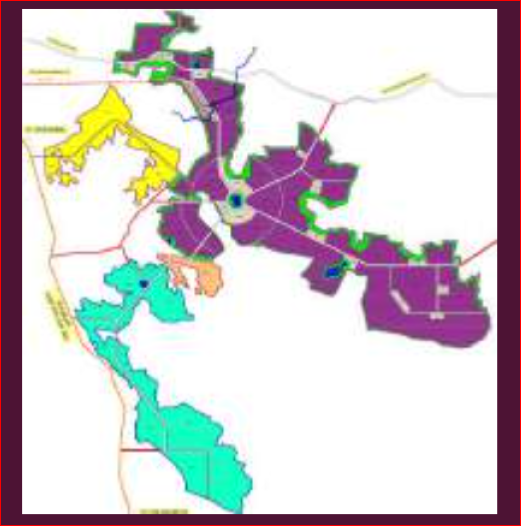
The HYDERABAD PHARMA CITY is proposed to be developed with integrated physical, environmental, social and technical infrastructure in an area of 19333.20 acres
You can down load G.O related to Pharam City
https://drive.google.com/file/d/1qhiklu5AZPzUeFouzFwp7H7Pls1eC7Si/view?usp=sharing
https://drive.google.com/file/d/1GIftGALl-O5a74pkOtlg0RJJakAk5Vdx/view?usp=sharing
Pharma City Components
Pharma city Site Road Linkages
• Nation al Highway 44 (Old NH 7): The Pharma Cit y site lies 30 km to the east of NH 44 (Varanasi Jabalpur- Nagpur-Hyderabad-Kurnoo l-Benga luru-Krishnagiri-Salem-Dindigul-Madurai-Kanyakumari), which forms the Nort h-South Corridor of NHDP.
• Srisailam Highw ay: This is the NH 765, erstwhile SH 5 that runs 6 km west of Pharma City Site and connects the region to Hyderabad . It is a 2 lane being widened to 4 lanes (stretch between Site and ORR is already upgraded to 2 lanes with shoulders). Sri sailam Highway connects Hyderabad to Tokapelle Road in Andhra Pradesh via Kalwakurt hy, Srisailam and Dornala.
• Nagarjunasagar Highway: This is SH 19 that connects Hyderabad to Nagarjunasagar. It runs 5 km to the east of Pharma City Site and connects the region to Hyderabad. It is an existing 2 lane road proposed for upgradation to 4 lanes.
• Hyderabad Outer Ring Road: The ORR runs 16 km to north of Site in E-W dir ection. It connects Srisail am Highway and Nagarjunasagar Highway to various parts of Hyderabad Metropolis. It is a 1 58 km long, 8 lane ring road expressway encircling the City of Hyderabad.
• Kandukur -YacharamRoad: This road connects the northern part of Site to both Srisailam Highway and Nagarjunasagar Highway. It runs through the Site fo r a distance of 3.3 km. This road is being planned for upgradation to 4 lanes from current single lane status by R&B Dept.
• Road connecting Raviryal Exit 13 of ORR and Sit e: This road connects northern part of Site to Hyderabad ORR at Exit 13 n e ar Raviryal. It fo rms an alt ernate connectivity to Site from ORR apart from Srisailam Highway and Nagarjunasagar Highway. It runs via Thimmapur and Begampet before connecting Kandukur & Yacharam near Mirkhanpet. It is a single lane road which is proposed for upgradation to 4 lanes by R&B Dept.
• Kadt hal - Shair eddygudem - Kurumidda Road: This road connects western part of Site to Srisailam Highway. It is a single lane village road from Kadtha l to Kurumidda via Shaireddygudem and Mariakunta Tanda. It runs through the Site for a distance of around 1.2 km.
• Road connecting Mirkhanpet and Tatiparti via Kurumidda : This road connects central part of Site to Kand ukur-Ya charamRoad. It is a singl e la ne village road that passes through the Site for a distance of around 2.5 km.
• Road connecting Wanaparthy and Cherikonda via Nakkertha M edipally: This road connects eastern part of Site to Kandukur-Yacharam Road. It is a single land village road that passes through the Site for a distance of around 3.5 km.
• Road connecting M ahisamma (Maisigandi) and Ekkuvapally: This single lane vil lage road connects Srisail am Highway to the nort hern part of the Site proposed for R&D and Ancillary Hub and runs for a distance of 2 km through the Site.
• Road connecting Site near Karkalpahad to Ekkuvapally : This single lane village connects a hamlet to the south of Karkalpahad along Srisailam Highway to Ekkuvapa lly and runs t hrough the Sit e for a distance of 2.6 km (in the site parcel identified for R&D and Ancillary Hub)
• Road connecting Ramanuthula - Konapur - Marripally - Ekkuvapa lly: This single lane village road passes t hrough the site parcel identified for R&D and Ancillary Hub for a distance of 2.7 km.
List of village in Hyderabad Pharma City.
Mucherla
Meerkhanpet
Panjaguda
Kurmidda
Medipally
Nanaknagar
Thadiparthy
Mudvin
KarkalPahad
Kadthal


